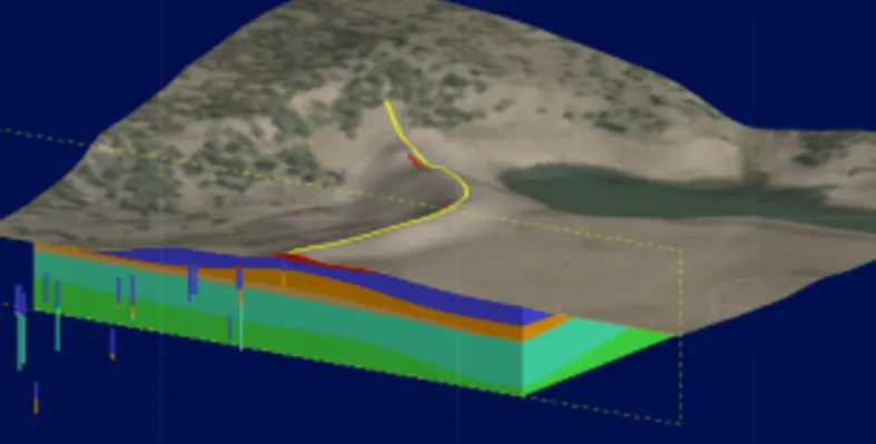
Seequent has included Geotechnical BIM concept in its Building Information Modelling/Management (BIM) with an aim to understand the the challenges and opportunities geotechnical engineers face to manage geotechnical structures built in real-time through geotechnical analyses rooted within the 3D geologic context
From Seequent’s vantage point, the asset might include dams, tunnels, deep excavations, waste rock piles, open pit mines and any other geo-structure.
All data for a project must exist in a centralised and accessible location, allowing data as well as metadata to be constantly updated for seamless sharing by multiple stakeholders. ‘Data’ in this context has an extremely broad meaning, covering everything from site characterisation and reporting to monitoring all within evolving site conditions. Change management is about version tracking the data through time.
At the core of BIM lies the digital twin. A digital twin is a digital representation of the physical system. In addition to the initial geologic model created for the site, the digital twin must also capture the evolving site conditions.
3D Geological Model
Seequent’s geological modelling and visualisation application, Leapfrog, is designed to provide the core elements of a digital twin for geotechnical engineers. A Leapfrog model is constructed from a wide variety of data sources including borehole, structural, GIS, geophysical, historical cross sections, geotechnical investigation data, and more. For a geotechnical engineer, a Leapfrog model could more aptly be called a subsurface digital twin because it can be used to model anything below the ground surface, including the geotechnical structure.
Geotechnical engineers often employ the observational method in design and construction to avoid highly conservative assumptions about ground conditions. The observational method requires continual updates to the geological model based on observed conditions and then modification of the geotechnical design as needed to ensure the final performance targets for the structure are achieved.
Geotechnical challenges and opportunities
The development and updating of the geologic model (digital twin) poses some major challenges for the geotechnical engineer, but also some useful opportunities. As the geotechnical structure evolves and new observational information becomes available, the geotechnical engineer faces the challenge of updating geotechnical analyses and interpretations in response to changing site conditions.
A 3D geological model (digital twin) provides the opportunity to visualise the location of monitoring instruments and/or create interpolant numeric models of the data all within the context of the geology and geotechnical structure.
Geotechnical analysis is done mostly in two-dimensional space. In linear infrastructure projects, geotechnical analysis is conducted on a series of cross-sections spaced along the center-line of the structure.
For more information, click here


